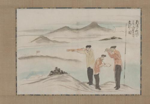


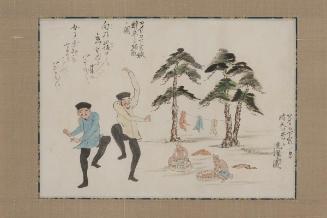
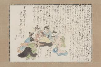
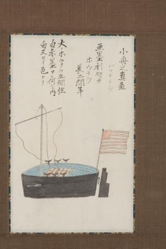
Picture of Surveying Distances and Recording Data on Land and Sea at Takehama, from the Black Ship scroll
Place of OriginJapan
Dateapprox. 1854
PeriodEdo period (1615-1868)
(not entered)Handscroll segment mounted as a hanging scroll
MaterialsInk and colors on paper
DimensionsH. 10 1/2 in x W. 15 1/8 in, H. 26.7 cmx W. 38.4 cm (image); H. 30 1/2 in x W. 20 in, H. 77.5 cm x W. 50.8 cm (overall)
Credit LineMuseum purchase with assistance from the Japan Society of Northern California
Object number2012.60.13
DepartmentJapanese Art
ClassificationsPainting
On View
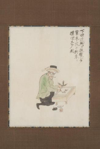
Not on viewInscribed武浜ニテ町間を量リ海陸共[木女]リ書キ記スノ図
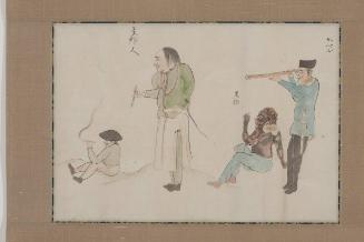
More InformationPerry’s men surveyed the coastal area around the small port town of Shimoda upon arrival. This painting captures three men with land surveying equipment such as a telescope, a plane table to record field observations and plot points, and a theodolite to measure distance and angles between designated points. The man in the middle, holding a paint brush, may represent Perry’s official artist William Heine, who was also known to have made topographical drawings and assisted in this survey.
![[Flags] Flying on Perry's Ships, from the Black Ship Scroll](/internal/media/dispatcher/11050/thumbnail)
Associated/Associated